

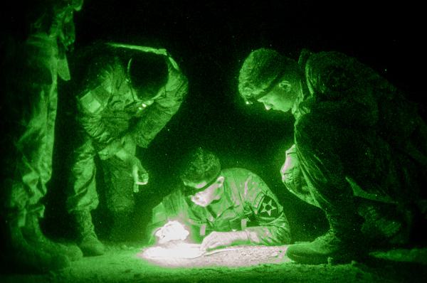
Camp Casey, South Korea. (April 30, 2024): Despite all the recent advances in GPS, Soldiers still need to know how to move people and equipment using a 16th century technology known as “dead reckoning.” In this photo by South Korean Army Corporal Mingyu Ju, Soldiers participating in a Best Squad Competition plan their route to move troops and tanks in total darkness.
Finding your way in the dark, or night land navigation, relies on techniques first used by Sailors in tall ships in the 1600s who plied the oceans before the discovery of America. “Dead Reckoning” uses calculations of one’s location based on the speed and direction from a known position. For today’s Soldiers, this means accurately plotting a course from their current position to their desired destination without the help of satellites.
The process begins with planning the route you wish to take given the terrain and distance involved. Troops use a standard military compass to “shoot an azimuth” or direction toward their objective expressed as degrees (example: 180 degrees). The route is then plotted on a 1:50 map (one inch represents 50,000 feet on the map) using a good old fashion number two pencil and a protractor. Exceptional care must be taken at this point as mistakes in calculations at the beginning are magnified over distance. If you are off by as little as half a percentage point at the start of the journey, you will find yourself way off course after travelling long distances.
Now that a destination has been plotted, Soldiers move out in that direction while keeping a careful count of the number of steps they take. This “pace count” is used to estimate the distance travelled toward the objective. As each objective is reached, a new course to the next location is plotted and double checked.
Finally, care must be taken to avoid detection by the enemy. Soldiers use lights (head lamps and flashlights) with red filters that are harder to see than white light (a sure giveaway).
When it comes to navigating at night, sometimes sixteenth century technology will do.