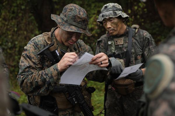
Camp Humphreys, Republic of Korea. (November 5, 2024): In this modern age, our military uses satellites, cell phones, and global positioning systems to find its way around. But what happens when the power goes out, the satellites are gone, and there is no “signal” to be had? In this photo by Staff Sergeant Ian Vega-Cerez, Korean and American Senior Enlisted Leaders plot grid coordinates during the land navigation portion of Mangudai 2024, an annual training event considered one of the toughest in South Korea.
Mangudai exercises reinforce mastery of core Soldiering tasks including live fires, patrol base activities, rendering casualty care under threat of mortar fire, a hand-to-hand combat challenge in a waist deep mud-pit, and miles upon miles of foot-marching through rain and the frigid cold.
But of all the skills put to the test at Mangudai, land navigation stands out because of its demand for accuracy, endurance, and leadership under extreme conditions. While our armed forces certainly take full advantage of today’s navigational technology, a simple and reliable compass-based system is still taught at infantry school.
Before the invention of the magnetic compass, the ancients relied on the sighting of landmarks, the position of celestial bodies, and even the flight path of birds to help guide their way. It was not until the Chinese Han Dynasty in 206 BC that a common fortune telling device was found to be useful as an aid to navigation.
What the Chinese discovered was that the Earth has a magnetic field that exerts force on a compass needle, causing it to rotate towards North. The first literary description of a compass in Western Europe was recorded in around 1190 and in the Islamic world and in Medieval Europe in the 1200s. The invention of the compass made it possible to determine a heading when the sky was overcast or foggy, and when landmarks were not in sight. This enabled mariners to navigate safely far from land, increasing sea trade which eventually led to the Great Age of Discovery in world history.
Today’s compasses are filled with a liquid to cushion the needle against shock and are designed for the adverse conditions faced by modern warfighters. The compass method continues to be used for land navigation due to its ruggedness and accuracy.
(Editor’s Note: For you new age types, Chinese magnetic compasses were possibly used to harmonize buildings by the geomantic principles of feng shui.)


