

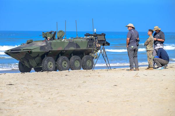
Oceanside, California. (March 12, 2025): When surfers “check out” the waves, it is for entertainment. For the Marines, knowing exact beach conditions can be a matter of life and death. In this photo by Michael Walls, scientists from the Naval Research Laboratory’s Ocean Science Division and Global TechSolutions demonstrate the new Marine Corps Surf Observation Tool (SUROB).
During the massive amphibious assaults in World War II, the Marines encountered unexpected wave conditions, currents, and man-made obstructions. Landing craft were thrown off course, capsized, or were trapped on hidden reefs resulting in high casualties. The only option then to obtain beach conditions was by dispatching special operations troops on extremely dangerous missions to check for uncharted reefs or man-made obstacles. Unfortunately, it took hours to gather this information and get it to decision-makers aboard ships.
Instead of hours, today’s commanders can receive vital information in real time. The SUROB system consists of an unmanned waterborne vehicle and a drone that can hover over the beach to take imagery. Combined with surface measurements, the system presents a comprehensive picture of the landing zone.
The system is the brainchild of Global TechSolutions, an arm of the Office Of Naval Research that produces innovations suggested by average Sailors and Marines of all ranks. The SUROB allows engineers to monitor the size of breaking waves, water depths, currents, and even scan beneath the surface looking for obstacles. All this data is transmitted to commanders in real time versus the fifteen minutes it takes for traditional surf observations. This new technology allows the Marines to make lightning-fast decisions for safer and more effective amphibious landings.
The Naval Research Laboratory provides scientific and engineering studies that drive innovations for the Navy and Marine Corps. It is staffed by over 3,000 scientists, engineers, and support personnel stationed around the country.